UO geologist Ray Weldon says that Eugene-Springfield residents need not lose sleep over a Cascadia earthquake damaging the eight dams located upstream from them. He’s more concerned about landslides triggered by large quakes along faults in the Cascades collapsing into the reservoirs.
Either way, the risks are low, Weldon said May 19 in a talk to the Eugene City Club.
“I’m as worried about landslides as I am about ground motion from Cascadia,” he said. “Either a Cascadia earthquake or an unknown crustal fault near a dam could trigger a large landslide into one of our reservoirs, which could lead to over-topping and subsequent erosion — as we came close to seeing in the extreme flooding at the Oroville dam in California.”
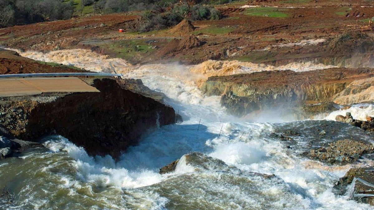
In February, heavy rain in northern California damaged the main spillway at the Oroville facility, forcing the evacuation of 188,000 people living downstream.
Weldon is well known on such matters. He advises several dam operators in California on earthquake hazards and is a member of the steering committee for the U.S. Geological Survey’s national seismic hazard mapping team. It is with that expertise that he addressed the safety of dams in Lane County. The county also is home to the Fern Ridge Dam that is downstream from Eugene.
The most dangerous scenario for Lane County’s dams is based on the possibility of a major rupture of the Cascadia subduction zone that stretches mostly along the coast from northern California to British Columbia. Even with a magnitude 9-plus Cascadia rupture, Weldon said, the level of ground shaking likely would diminish as it moves toward the dams.
“Forecasts of strong ground motion at a site due to earthquakes are usually calculated probabilistically,” he said. “This is what my colleagues at the USGS, my students and I do to make the national seismic hazard earthquake source model from which we generate maps of hazards and risks that are used to set building codes and to guide insurance rates, risk reduction and emergency preparedness efforts.”
The resulting building codes, he explained, are more about the chances of a roof coming down during a structure’s lifetime than the magnitude of an earthquake directly underfoot. The models address a high level of shaking that might be exceeded 2 percent of the time in 50-year intervals, he said.
Hazard models are based on geological and historical evidence of such things as earthquake strength and intervals. The danger of a major Cascadia rupture was not known when Lane County’s dams were built, and little is known today about crustal fault lines in the Cascades, Weldon said. The last major Cascadia rupture occurred in 1700.
Standards for Lane County’s dams — embankment structures made of rock fill or other material and completed by the late 1960s — were established to account for worst-case scenarios for heavy-rain events on timescales of 10,000 to 100,000 years, said Eric Peterson, operations project manager for the Willamette Valley of the U.S. Army Corps of Engineers Portland district, also a City Club speaker. (The talks by Weldon and Peterson may be heard at KLCC's City Club webpage.)
Weldon and his UO colleagues are working to close some of the uncertainties that go into hazard models.
They are studying data and using new techniques to study past earthquakes — and new ones — to understand shaking duration, rupture direction and depth, and how far shaking extends from a rupturing fault and at what levels. They also are locating and dating landslides in the Oregon Coastal Range and Cascades to determine potential risks to the area’s dams.
UO researchers, Weldon added, also have been working with the Oregon Department of Geology and Mineral Industries to locate and map previously unknown crustal fault zones. Several have been found.
Crustal earthquakes are common in the Pacific Northwest and occur at shallow depths, as opposed to subduction zone earthquakes, at deeper depths, driven by the movement of tectonic plates under a fault zone.
Given funding resources, the UO’s researchers can continue to gather such information to help inform better hazard models for the future, he said.
For now, Weldon said, the greatest likelihood of a major earthquake is a magnitude 8 off the southwest Oregon coast, which, he added, will not damage the region’s dams.
“The current model has a magnitude of up to 7.9 on a crustal fault in the Cascades,” he said. “To me, that sounds pretty big. In the model that is quite rare, an event that occurs about every 10,000 years or so. In my mind, the worst-case scenario is that we’d have a large magnitude 7 that would cause some of these very large landslides that we see in the landscape at one of the reservoirs.”
—By Jim Barlow, University Communications


