The University of Oregon is tapping homegrown technology, expertise and ingenuity for solutions to many of the challenges posed by planning for in-person, on-campus instruction this fall.
One of the big issues is how to reconfigure space on a nearly 150-year-old campus that was designed to bring people together to learn, not keep them apart.
Physical distancing, the concept of staying at least 6 feet from other people and not gathering in large groups, is one prescribed way to reduce the spread of COVID-19. That means the university has to think differently about how it uses every kind of space on campus, from classrooms and offices to residence halls and the Erb Memorial Union.
“The world has changed and every college campus has to figure out how it’s going to use space differently, how it can bring students back safely following public health experts’ physical distancing protocols,” said Andre Le Duc, chief resilience officer and associate vice president. “When it comes to space utilization we’re ahead of the curve at the UO in that we have comprehensive mapping technology in place and were able to figure this out quickly.”
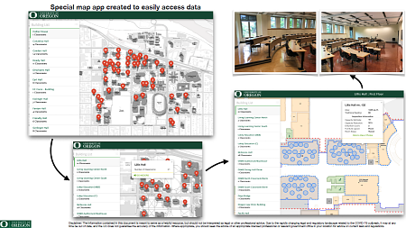
Ken Kato is director of the UO’s Location Innovation Lab and Campus GIS and Mapping Program. His team has spent years building software applications and data systems that create a variety of maps to highlight information that’s useful to the campus community, like the location of current construction projects, lead testing and mitigation efforts and storm damage.
Kato’s team was quickly pulled into the fall planning efforts led by Le Duc and the UO’s Incident Management Team. Based on guidance from health authorities, the UO is creating appropriate physical distancing protocols that follow state and federal guidelines in classrooms, labs, residence halls and other campus buildings.

The custom software from Kato’s Location Innovation Lab, which is a division of Safety and Risk Services, enabled staff to complete this work in a matter of days, not weeks or months.
This information is critical as a fall planning task force, comprised of members of the provost’s and registrar’s offices, the University Senate and Deans Council, develop scenarios and course schedules for fall.
Janet Woodruff-Borden, executive vice provost for academic affairs, said the task force is taking a hybrid approach to scheduling that allows classes with fewer than 50 students to happen in person and larger classes to be taught remotely. Enough core classes will be available online to accommodate students who want to carry a full course load and continue studying remotely.
“It’s been a lovely team effort to make this work,” Woodruff-Borden said. “People who may have never met before are working in unison to develop a thoughtful plan for fall that takes into account the needs of students, faculty and staff. The community that has come together is an amazing and truly resilient group.”
But the ability to do this type of work at the UO didn’t happen overnight.
“We’ve been honing room-level information across campus and developing a number of apps over the past few years, apps that can drop a pin in any of the 25,000-plus rooms on campus and hook into other data,” Kato said.

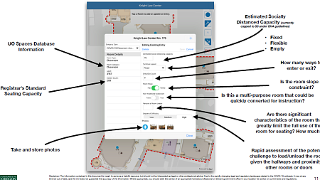
That technology was modified over the course of one weekend to help the university examine how rooms could be used for fall classes while allowing a 6-foot diameter space per student, which conforms to health and safety guidelines.
“Where rooms once had a fire code occupancy or instructional occupancy, the UO is building a COVID-19 occupancy,” Le Duc said. “Spaces that don’t meet the threshold for physical distancing are not an option. The first step in resuming in-person classes is to understand what spaces on campus can be utilized.”
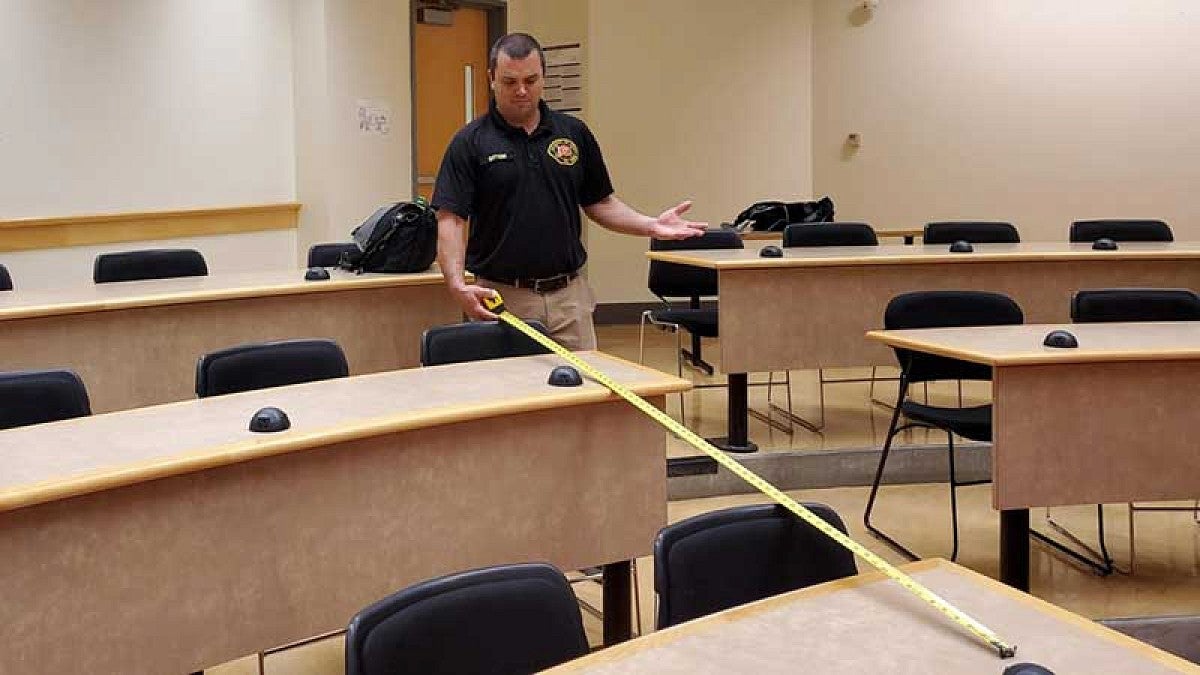
Once the mobile application was modified, members of University Fire Marshal Group and Environmental Health and Safety fanned out across campus armed with tape measures and laser measuring tools. Their job was to reassess the spacing of 300 classrooms and expand the map database even further with photos of entrances and exits, and variables such as fixed or movable furniture.
“Few, if any, of our peers have been able to move this quickly,” Kato said. “Our platform is unique in that it can launch a new app in a few hours. The data input is real-time, so our teams were able to watch as photos and information were uploaded.”
—By Kay Jarvis, University Communications


