
As wildfires rise, so does the threat of landslides. A UO geologist ventures into the Columbia River Gorge to investigate what this means for the Pacific Northwest.
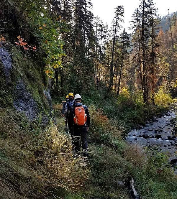
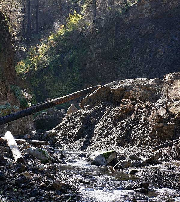
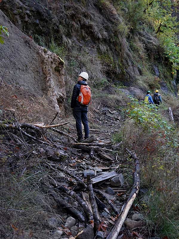
A loose rock topples down a steep hillside in the Columbia River Gorge. Raucous clacks ricochet through the crisp fall air as it bounces across a sprawling mound of talus.
The rogue stone slowly rolls to a halt amidst thousands of other pieces of debris that climb the slope for as far as the eye can see–it’s a freight train of rubble.
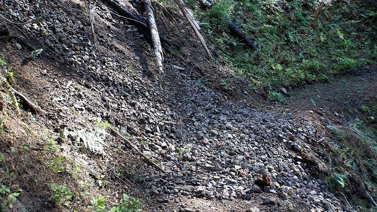
“Imagine that sliding at 20 to 30 miles per hour,” says UO geologist Josh Roering, as he gestures to the long chute of rocks and charred wood. “That’s what was happening during the fire.”
The fire he is referring to is the Eagle Creek fire, which was ignited in early September, 2017. The blaze spread across 47,000 acres of the Columbia River Gorge as it burned for nearly three months, torching land on both sides of the river and devastating the many Oregonians who cherish the landmark.

Roering is hiking through the burn area because he has turned the scorched forest into a research site to study the relationship between wildfires and landslides in the Pacific Northwest.
“As wildfire activity in the west increases, the likelihood of rapid, highly destructive debris flow is also significantly increasing,”
Roering says, noting that more wildland firefighters have perished from falling debris than fire.
When flames ravage groundcover and vegetation, it leaves soil susceptible to untamed sliding, he explains, and spurs rapid soil erosion and rock fall.
“Vegetation stabilizes steep landscapes,” Roering says. “But fire disrupts that relationship when it incinerates vegetation and biomass, and that can trigger slides on steeper slopes.”
Like the scattered remnants of the one in front of him, which he estimates was moving as fast as a charging grizzly bear during the heart of the fire.
In other regions that experience widespread fire activity, landslides in the aftermath of wildfires have become a risk to public safety. In Santa Barbara County in early 2018, 21 people died in mudslides triggered by heavy rain after the area’s Thomas Fire and smaller blazes.
“Before the rains came last fall, many people were wondering if there would be a similar fire-flood sequence in the Columbia River Gorge,” he says.
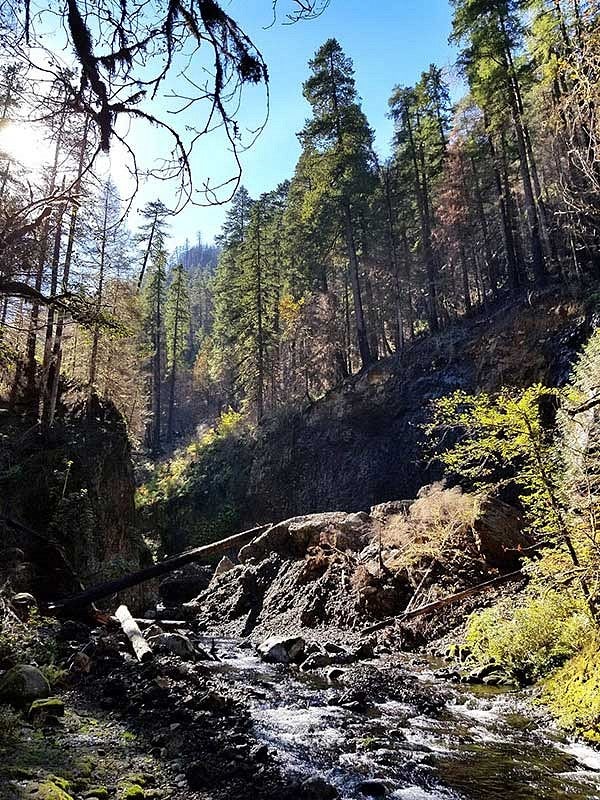
The Columbia River Gorge is a popular recreation area, situated close to Portland, and home to a number of hiking trails, including a stretch of the Pacific Crest Trail. It’s also a major transportation and communication artery, with Interstate 84 snaking through the gut of the canyon, and the tall concrete piers of the Bonneville Dam protruding from the depths of the expansive river.
This bustling hub of activity has a number of government agencies and nonprofit organizations supporting Roering’s research efforts.
“There’s an urgency to collect data and field observations that could impact management activities,” he says. Roering is an avid outdoor enthusiast himself, filling many weekends with backpacking trips, snow outings, and family hikes. It’s not surprising that his work focuses on how the Earth evolves through factors like wildfire, climate change, and glacial melt.
Roering is what’s known as a geomorphologist. His research examines how landscapes are shaped by mechanical, chemical, and biological processes. Including fire.
“We want to understand how landscapes evolve if fire gets involved,” he says.
“One of the most immediate questions we’re investigating is: What hazardous conditions to human life and infrastructure are created during and after a fire?”
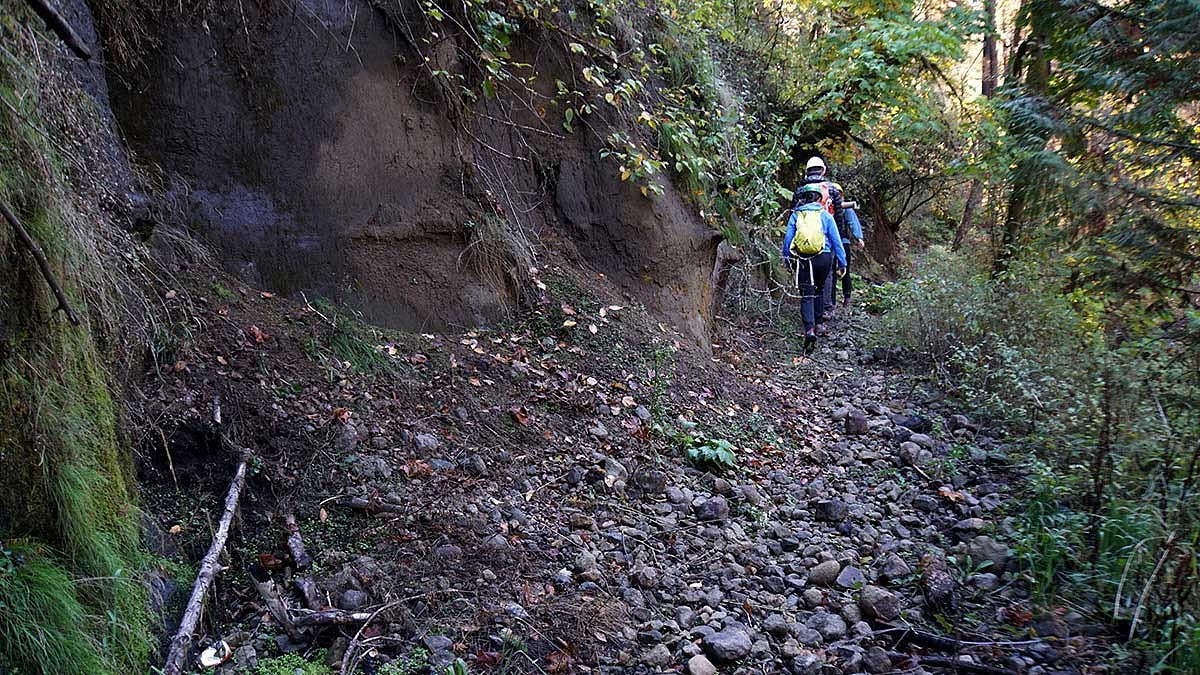
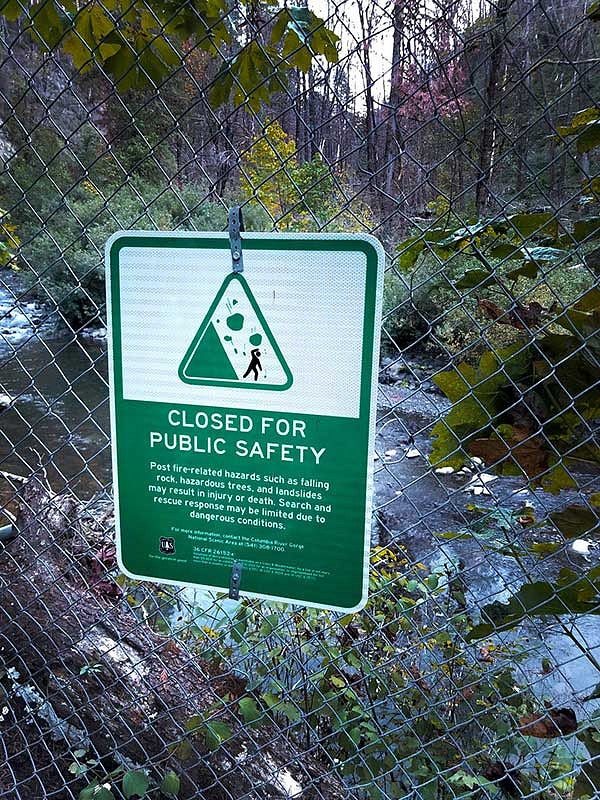
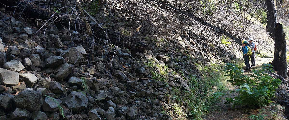
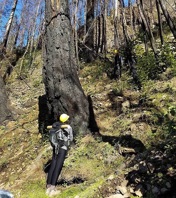
The area Roering is hiking through is still closed to public use, nearly a year after the fire was extinguished. Wire gates stretch across the quiet trailhead, covered in signs that carry warnings about overhead hazards and rock fall.
Roering dodges a small cluster of rocks that litter the trail, clearly fresh additions to the winding path.
He explains that there are two phases of erosion caused by wildfire: during the blaze and after it’s been extinguished, sometimes long after. He’s aiming to measure the former and gauge the risk of the latter.
Some of the lingering risk is through small hiccups of activity, like the lone rock somersaulting down a slope.
But Roering is especially interested in understanding the threat of larger landslides and erosion, which can happen a full decade after the last flames of a wildfire have stopped flickering.
“The matter has been well researched in areas like Southern California, but there’s still uncertainty with the Pacific Northwest, due to its vastly different landscape, namely the soil composition and mosaic of vegetation,” he says.
“Especially in the Columbia River Gorge, which has a distinctive geological history and is comprised of many steep, tree-covered slopes.”

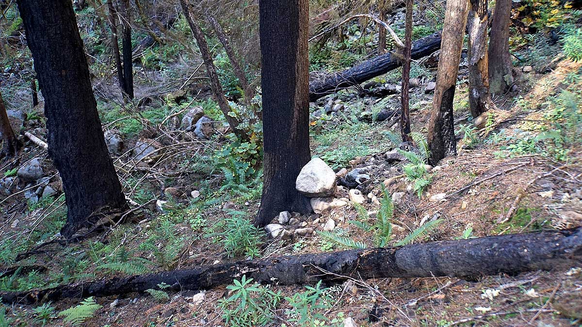
The slopes do look strikingly different from those in a hot, arid region. They’re cloaked in lush green, bursting with tufts of ferns and bunches of underbrush. Towering fir trees cast a thin canopy overhead.
It’s difficult to tell a fire even swept through a mere year ago.
“It’s pretty remarkable how much has grown back,” Roering notes, as he cranes his neck to scan the hillside.


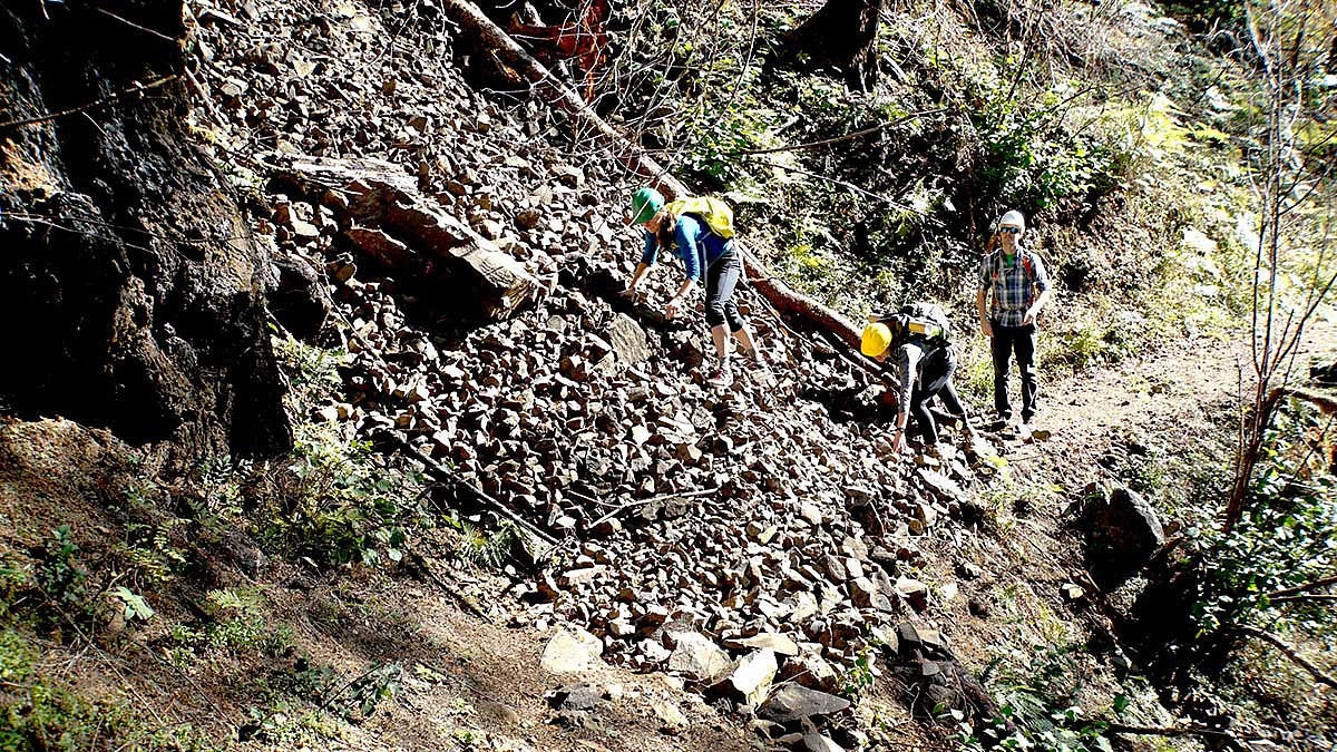
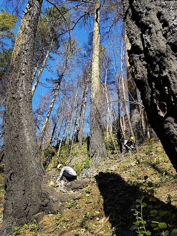
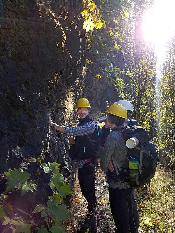
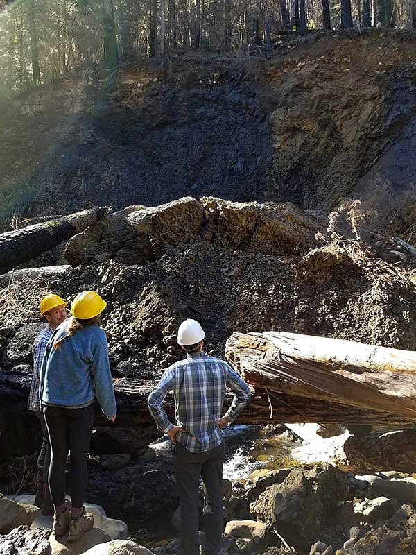
The bustling regrowth is a reality that complicates certain aspects of geological field work. As Roering and two of his PhD students walk through the gorge, they’re noting evidence of erosion — of which there is no shortage – and discussing whether it stemmed from the fire.
They want to measure the erosion instigated by the fire, as well as identify conditions that contribute to sliding, like slope angle and composition of soil and vegetation.
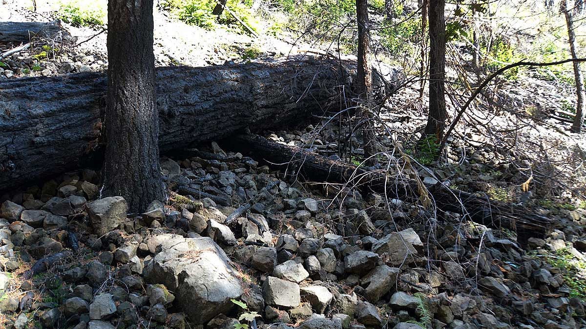
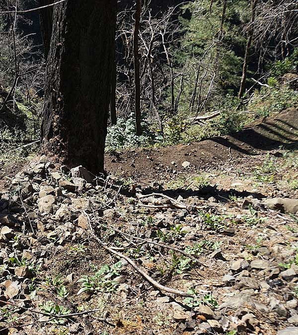
Some erosion can be easily linked to the fire: Mammoth blackened trees spearing piles of rocks, mounds smattered with crisped bark.
Other displays are less obvious.
The geologists pause in front of an embankment that’s covered in rocks and start piecing clues together.
“There’s a lot of moss on this surface,” notes Roering, suggesting the rock was parked there before flames rushed through.
“But, here’s a burned tree limb,” chimes in Brooke Hunter, a PhD student.
“It would make our jobs a lot easier if we could pick up a rock and ask it where it came from,” joked Roering.
But they can’t just interrogate every rock they meet.
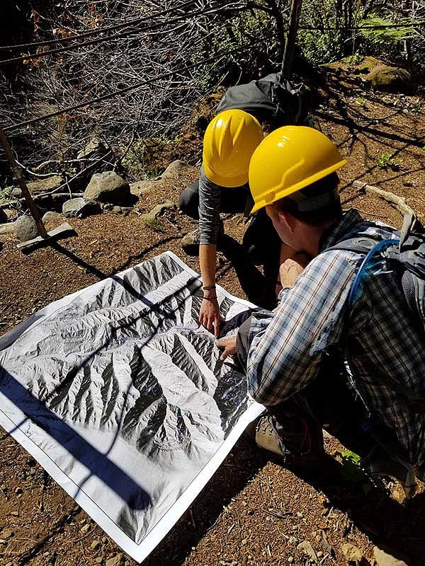
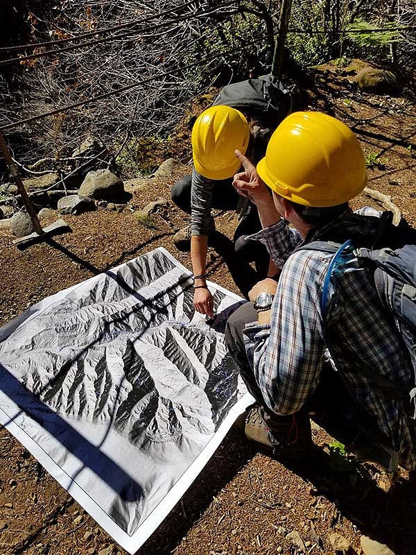
So, instead, one of the tools they’ve employed in their research is a remote-sensing technology known as airborne Light Detection and Ranging (LiDAR). This surveying method allows the geologists to penetrate the tree canopy — a prevalent feature of the Pacific Northwest — and detect changes in the landscape below, like where erosion has occurred.
“It’s the only way we can see through the trees,” Roering says. “It can map the surface of the land in incredibly high detail.”
A Closer Look at LiDAR
Some of the terrain in the Columbia River Gorge calls the reliability of LiDAR data into question, namely in its steepest crevices, where it is difficult for the planes to adequately reach every crevice of land. PhD student Brooke Hunter is examining this issue to identify possible inaccuracies in the data and help researchers better understand the nuances of LiDAR.
“The topography of the canyon presents a challenge for this technology,“ she explains. “Our goal is to determine which factors will give researchers high confidence in LiDAR data, and which conditions merit further examination.”
By comparing datasets from 2014 to those taken in the wake of the fire, they can identify significant differences, which indicate likely erosion. The imaging will enable the geologists to measure the amount caused by the fire.
On this sunny October afternoon, the trio is equipped with a map of the LiDAR data. Cobalt splatters mark recent erosion — or, at least that’s the theory. As they hike, they’re noting where their observations match and where they diverge from the airplane-collected data to help inform Hunter’s research.
But as much as LiDAR has revolutionized the field of geology, they can’t rely on the tool to answer every research question, especially concerning the threat of future landslides.
While Roering thinks the fire, flood sequence that devastated Southern California is unlikely due to the terrain differences, he believes the Eagle Creek fire could have devastated tree roots, which can take up to a decade to deteriorate.
“If roots take 3–10 years to decay, that opens up a window of vulnerability for shallow landslides,” he explains.
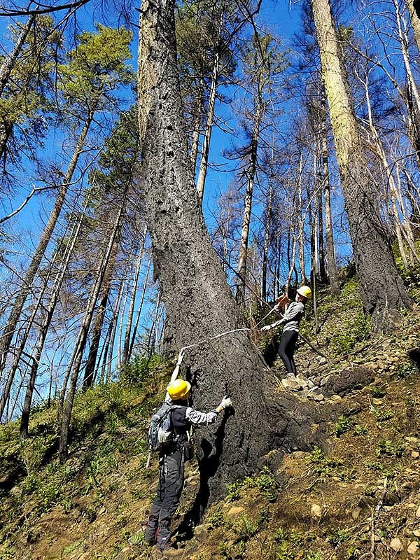
The group stops in front of a tree, where a mound of debris has accumulated on the uphill side of the trunk.

“Let’s get some measurements,” he calls.
Hunter stretches the measuring tape across the trunk and surrounding rubble, calling out data.
This aspect of their research is still in its infancy, they will continue to test root strength for years to gauge the fire’s long-term effects and threats. They will also capture annual LiDAR data to measure the rate of erosion over time.
As they hike back to the trailhead, the geologists pause in front of various rock structures and rubble mounds, tossing theories around about what happened to the landscape during the fire, and what will transpire in the future. This is how research questions take root and grow, Roering says.
Science indicates that as the climate changes, wildfires will persist across the Pacific Northwest, as will the threat of landslides–and the work of these geologists.
“We’ll do this for a lifetime,” he says.
Undergrad Landslide Research
UO senior Emily Perman was inspired to pursue a similar research project in Southern Oregon for her honors thesis, under the advisement of Roering. She’ll use LiDAR data and field work to gauge landscape changes and erosion caused by 2013’s Big Windy Complex fire near Glendale, Oregon. The pattern of land ownership, which rotates between the Bureau of Land Management and privately-owned timber companies, is providing her with an opportunity to also investigate how forest management influences what fire does to a landscape.
“I’m excited to see if there are any implications from land use and whether it’s been intensively managed or left alone,” she says. Perman was motivated to conduct this research by the environmental changes she’s witnessed in her lifetime. “Fires are becoming such a problem, especially on the west coast.”


