Editor’s note: This article is republished as it appears in The Conversation, an independent news publisher that works with academics worldwide to disseminate research-based articles and commentary. The University of Oregon partners with The Conversation to bring the expertise and views of its faculty members to a wide audience. For more information, see the note accompanying this story.
Just a few times in a century, somewhere on the globe, a rare “tsunami earthquake” occurs. These are mysterious because, while they’re just medium-sized as earthquakes go, they cause disproportionately large and devastating tsunamis. This type of midsized earthquake is very different than an event like the 2004 earthquake in Sumatra, a very big magnitude 9.2 event which unsurprisingly produced a huge tsunami.
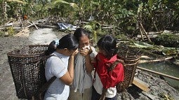
The most recent tsunami earthquake happened in 2010. A magnitude 7.8 earthquake off the Mentawai Islands in Indonesia set off a tsunami that was over 50 feet in height in some places, much greater than seismologists would predict based just on the earthquake’s size. More than 500 people were killed, and 15,000 more were displaced or left homeless.
Tsunami earthquakes are particularly destructive and dangerous because the massive tsunami waves can hit local coastal communities within just five to 15 minutes, before officials can issue a warning. But based on our analysis of previously unavailable closeup observations of the 2010 Mentawai event, my colleagues and I think there is a way to determine that an event is a tsunami earthquake in time to warn people that an unexpectedly large wave is on the way.
Earthquakes under the ocean
The Earth’s surface is made up of floating tectonic plates that fit together like a slightly imperfect jigsaw puzzle. These plates are moving next to, under or away from each other.
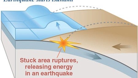
Meanwhile, the shallowest area of a subduction zone, closest to the seafloor, is made up of soft sediments that are not very strong. Earthquakes rarely occur only here, because stresses mostly don’t build up in these soft, weak rocks.
Geoscientists define an earthquake’s overall size with its magnitude. Earthquake magnitude describes how much “work” is accomplished by the earthquake moving the fault — more work for either more movement, or for moving more rigid rock.
What sets tsunami quakes apart
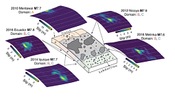
“Tsunami earthquakes” are strange in that they happen almost entirely in the soft, weak section of the fault.
Because tsunami earthquakes break such soft rock, they happen slower, and create much more movement on or near the seafloor in comparison to a normal subduction-zone earthquake of the same size that happens in rigid rock. This in turn creates a much larger tsunami than expected.
Think of breaking a thick slab of concrete, which is strong and would produce an audible bang with both low and high-pitched noise, versus breaking a loaf of bread, which makes almost no sound at all. In the Earth, “sound” is the shaking you feel under your feet. The soft bread break is like a tsunami earthquake that doesn’t release a lot of high-frequency energy, and thus doesn’t create as much shaking as we would expect for its magnitude.
Sensing quakes in time to warn
Currently, officials rely on knowing an earthquake’s magnitude and location to issue tsunami warnings within tens of minutes. But this doesn’t work in the case of tsunami earthquakes, because the earthquake’s magnitude doesn’t match up with the size of the tsunami it produces.
Instead, to figure out whether an earthquake is in fact a tsunami earthquake, scientists compare its seismic magnitude measured from afar with the amount of high frequency radiated energy it produced, as recorded by far away stations.
If the ratio of energy to magnitude is very low, it’s a tsunami earthquake; basically, its shaking was far too weak for its magnitude because it was breaking soft rock. Instead, its energy is of the low-frequency type: Rather than strong shaking, its energy goes into large slow movement of the seafloor and the ensuing tsunami.
Now my colleagues and I have for the first time analyzed data recorded by seismic stations that happened to be near the epicenter of the 2010 Mentawai earthquake. We think we have figured out a new way to identify the danger of a future tsunami earthquake, faster.
Closer and quicker proxies
Our new study used the same concept of comparing the energy released by an earthquake to its seismic magnitude but based on data from geographically close to the event. Instead of looking at energy measurements recorded at a distance, we used two proxies.
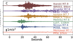
To look directly at how much the ground shook, we used seismic stations onshore near the epicenters of 16 earthquakes, including the Mentawai one in 2010. Because the amount the ground accelerates when seismic waves pass through illustrates how much high frequency energy is in the earthquake, this information was a stand-in for the data we would traditionally get from the far-flung teleseismic stations. Low accelerations mean little high frequency energy.
For the normal earthquakes we looked at, the accelerations from near-field seismometers were close to what we’d expect for each earthquake’s magnitude. In comparison, the 2010 Mentawai earthquake’s accelerations were closer to what we would expect for a magnitude 6.3 earthquake, whereas the earthquake was actually a magnitude 7.8, and produced a tsunami we’d expect for an event of greater than magnitude 8.
We also looked at GPS stations close to the earthquakes. They can show us how much the ground actually moved or was displaced, and measure the earthquake magnitude itself.
Using these measurements together allowed us to compare the amount of energy in the earthquake with respect to its magnitude without waiting for the seismic waves to travel across the globe. Instead, we would have been able to identify a tsunami earthquake immediately by looking at how low the accelerations were on local seismometers in comparison to the magnitude of the earthquake based on GPS readings.
We think our finding is really promising because these near-field measurements are available immediately, even while an earthquake is happening. Seismologists could use this approach in the future, to identify a tsunami earthquake right after it happens, and provide warning to the nearby coast before the tsunami wave arrives.
—By Valerie Sahakian, assistant professor of geophysics


