
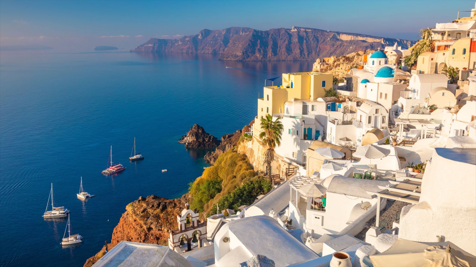
The Greek island of Santorini is famous for its postcard-perfect views: white buildings perched on high cliffs, rising above the brilliantly blue water of the Aegean sea.
But what most captivates UO geophysicist Emilie Hooft about the island lies beneath the surface: a string of underwater volcanoes that created the island and others in the chain via a series of eruptions.
The island of Santorini is part of the caldera rim of a volcano bearing the same name. About 3,600 years ago, during the Bronze Age, the Santorini volcano erupted dramatically. It set off tsunamis and buried towns in ash, possibly affecting global climate and contributing to the demise of the Minoan civilization.
For almost ten years, Hooft has been using state-of-the-art imaging to study the volcanic systems underneath Santorini. Alongside collaborators from around the world, she hopes to use geophysics to understand the dynamics of Santorini’s Bronze Age eruption, as well as predict future geological hazards in the area. Hooft’s mapping work continues to pay dividends. It has spurred and supported several new papers examining the complex dynamics of the Santorini volcanic system and other nearby volcanoes.
“Santorini is really unique because so many people have studied it,” Hooft said. “It’s interesting historically, in terms of the impact on archaeology and development of western civilizations. And we have so much data on it, which allows you to get a really rich picture of one volcano.”
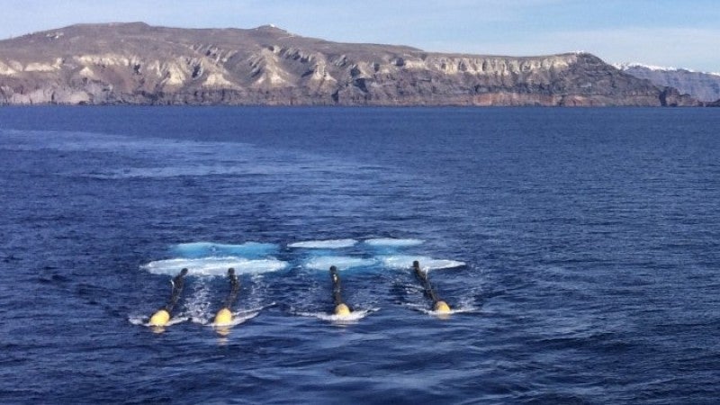
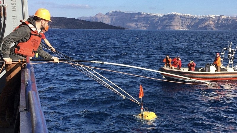
Hoof began working on Santorini in earnest in 2015, when she and UO earth scientist Doug Toomey led an international team of scientists on an expedition aboard a research vessel. Hooft and her colleagues planted seismic sensors on the ocean floor and on the island of Santorini itself. Then, they used canisters of compressed air to send powerful sound waves through the ocean, like an underground ultrasound. The speed of those sound waves depends on the kind of material — lava, rock, water — they’re moving through. All told, the team collected more than 200,000 data points. They used that to reconstruct a detailed 3D map of Santorini’s volcanic plumbing.
But even that top-notch mapping missed a few things, one of Hooft’s most recent studies suggests. On the 2015 trip, the research team had also mapped Kolumbo, another underwater volcano just a few miles from Santorini. Recently, Hooft and an international team of collaborators revisited the data with an even more powerful new analysis technique and discovered an active magma chamber inside of Kolumbo that had gone unnoticed on the first pass of mapping.
The technique, called full waveform inversion, analyzes the same seismic data in more detail, giving a clearer picture. That means it can detect smaller objects that other methods might miss — like a relatively small magma chamber, less than 2 kilometers across.
The magma chamber could be a hazard that warrants future monitoring, Hooft and her colleagues suggest in a paper published in the journal Geochemistry, Geophysics, Geosystems.
RELATED LINKS
“This result starkly highlights the resolution limits of the imaging methods typically used to look for magma bodies,” Hooft said. “Notably, our first results missed one of the most important features of the volcano.” The same imaging technique could be used on other volcanoes, to scan for previously undetected hazards.
In another recent paper published in Nature Geoscience alongside collaborators at the University of British Columbia, Hooft and her colleagues turned to the seafloor around Santorini for clues to the dynamics of its massive eruption.
When Santorini erupted, plumes of ash, rocks and gas spewed upwards. As that material fell down in waves, it left behind terraced deposits of sediment on the seafloor around the volcano, spreading out like ripples in a pond. While doing the seismic imaging work in 2015, Hooft and her colleagues also created an extraordinarily detailed map of the seafloor around Santorini using other instruments aboard the ship. That map gave a close-up look at the sediment ripples.
Now, by analyzing these ripples, Hooft and her team hope to piece together the dynamics of the eruption that sowed them, like tracking fingerprints at a crime scene.
Hooft’s collaborators at UBC set up lab experiments where they spewed fine particles underwater to simulate different eruptions and look at the kind of deposits left behind. Using physics models, the team could link certain eruption conditions to the particular terrace patterns recorded in Hooft’s maps, and from that, piece together the dynamics of the eruption.
“You can use the pattern of the terraces to understand the strength of the eruption and learn something more about how this volcano typically behaves,” Hooft said. “The processes of the falling ash hitting the sea surface and sinking are really cool; it’s amazing to imagine how this generates waves to form tsunamis.”
Volcanologists are still figuring out how unique individual volcanoes can be, and the degree to which conclusions drawn from one volcano can be translated to another, Hooft said. But understanding volcano dynamics might help improve hazard forecasting and prediction more generally.
Two PhD students in Hooft’s lab continue to mine this rich data. Beck Hufstetler is mapping the melt content of the magma system using earthquake recordings from the region. Kaisa Autumn is searching for deep magma under the volcano, using sound waves that get reflected back from the boundary between the earth’s crust and mantle.
Hooft is still working with other scientists to understand the structure and dynamics of Santorini. The International Ocean Discovery Program just completed a mission to the area. Scientists on the mission collected cores of rocks from the seafloor around the volcanoes, which will allow them to map eruptions back through time. Hooft is eagerly awaiting their results.
And she hopes to return to Santorini herself someday. One future goal is to collect electromagnetic measurements around the volcano as a way to map magna pathways. The data will complement the data from 2015, leading to an even clearer picture of the volcano’s hidden dynamics.
“Santorini is important because it’s an iconic volcano and also one of Greece’s major tourist destinations” Hooft said. “This volcanic group has produced many eruptions in the past, and some of them were very explosive.”
— By Laurel Hamers, University Communications