Each spring in the high desert basins of western Wyoming, thousands of mule deer begin surfing the “green wave” in a long-distance quest for survival.
These deer are lean and undernourished after spending the winter foraging for food in the snow-covered sagebrush plains.
As the snow melts in the foothills and mountains, the hungry animals embark on epic journeys, some more than 100 miles one way, seeking out tender grasses and wildflowers pushing through the thawing earth. The deer may pause for days or weeks to refuel en route to their summer range in the mountains. In fall, when the snow flies, they depart the mountains and retrace their steps to the winter ranges.
RELATED LINKS
These are perilous journeys: the animals can drown in rushing rivers, get eaten by wolves, or stay too long in the mountains and become snowbound. Add to that the threats posed by humans—infrastructure tied to energy development, barbed-wire fences, and busy highways. About 3,000 deer are killed on Wyoming highways every year.
These and other factors have contributed to a 36 percent decline in mule deer populations in Wyoming since 1990, according to The Nature Conservancy.
Migrations like these are undertaken around Wyoming by more than a million pronghorn, moose, bighorn sheep, mountain goats, bison, and other hooved mammals known as ungulates. These treks have taken place for millennia. Now, thanks to a six-year collaboration between wildlife biologists from the University of Wyoming and cartographers from the University of Oregon, researchers have new insight into the animals’ movements across these rugged landscapes—including the barriers they encounter along the way and potential conservation actions that can make these journeys easier.
Wild Migrations: Atlas of Wyoming’s Ungulates, published last fall by Oregon State University Press, documents the animals’ journeys with words, photographs, and detailed maps.
The project was led by two Ducks: Matthew Kauffman, BS ’92 (biology), and Jim Meacham, BS ’84, MA ’92 (geography). Kauffman is a professor who studies wildlife biology at the University of Wyoming and Meacham is executive director of the UO’s InfoGraphics Lab.
“Maps can really tell powerful stories if they are done clearly and are accessible,” Meacham says. “The goal is that people will have a deeper understanding of the importance of the migration corridors, what these animals are doing, and that leads to better understanding of potential or existing threats and opportunities for conservation.”
Among the stories these migrations tell: how mule deer time their journeys to the mountains with the pace of the spring “green up”; how ungulates must learn when and where to migrate, and how they pass this knowledge across generations; and how bison change their winter movements when they encounter heavy snow.
The atlas features stunning photos from Joe Riis, a National Geographic photographer, evocative essays by natural history writer Emilene Ostlind, and a foreword by Annie Proulx, the acclaimed writer and former Wyoming resident.
When Kauffman joined the University of Wyoming faculty in 2006, he began studying the hooved animals that roam the state’s plains and mountains, looking at how mule deer respond to energy projects, for example, and why the moose population near Jackson was in decline.

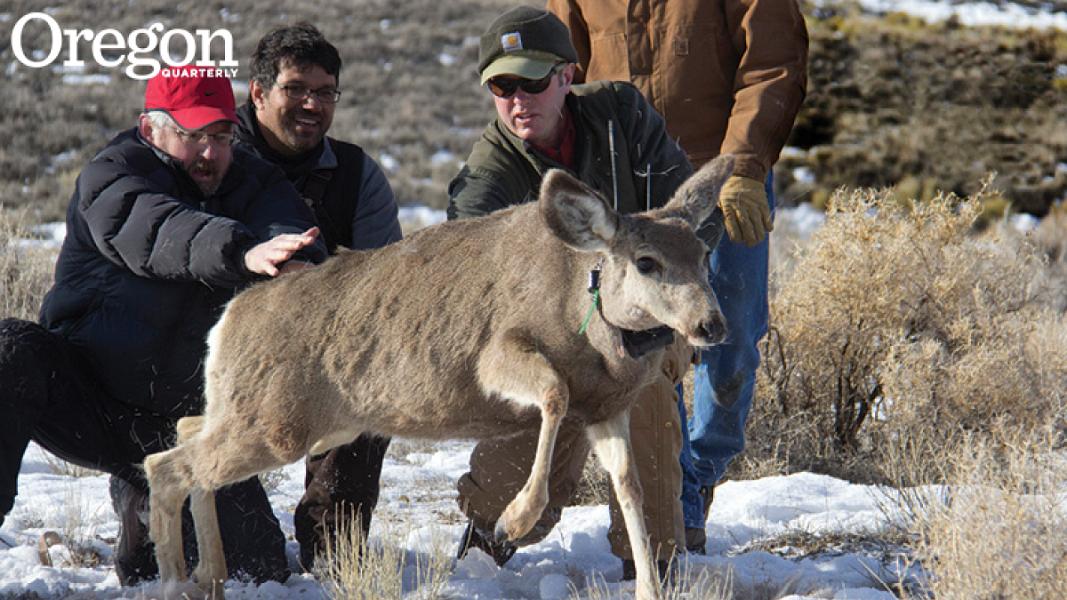
As Kauffman and his team retrieved the collars and looked at the data, the migration patterns of the animals were revealed. He soon realized the importance of these seasonal movements to the health of Wyoming’s ungulates.
Their movements raised questions that fascinated Kauffman: How do the ungulates navigate? Why are some migrations declining? How are the animals responding to climate change? How are their migrations affected by fences, roads, and energy development?
“I was just drawn to it,” he says. “As the animals were revealing these remarkable migrations to us, you couldn’t not look at them.”
That led to an epiphany.
“How is conservation getting done if we haven’t mapped the (migration) corridors?” he asked. “We could do a much better job of conservation if we had better maps.”
There was one problem: Kauffman is a wildlife biologist, not a mapmaker. But he was familiar with the work of UO cartographers, led by Meacham, who had produced the Atlas of Oregon in 2001, and in 2012, the Atlas of Yellowstone, two volumes that told the story of place through detailed maps.
Kauffman pitched to Meacham the idea for an atlas of migrations and soon Meacham and fellow cartographers from the UO’s InfoGraphics Lab were working with the Wyoming biologists.
“We, as cartographers, are applying our expertise in cartographic design and scientific visualization to help them communicate their stories to a broader audience,” says Meacham.
The UO team included Alethea Steingisser, MS ’06 (geography), as production manager, and about 15 undergraduate and graduate students who contributed to the project over a period of six years.
“The ultimate goal,” Meacham says, “is providing information that can facilitate the conservation of these spectacular migration corridors that are under threat.”
Maps produced for the atlas have already proven critical in preserving migration corridors, Kauffman says.
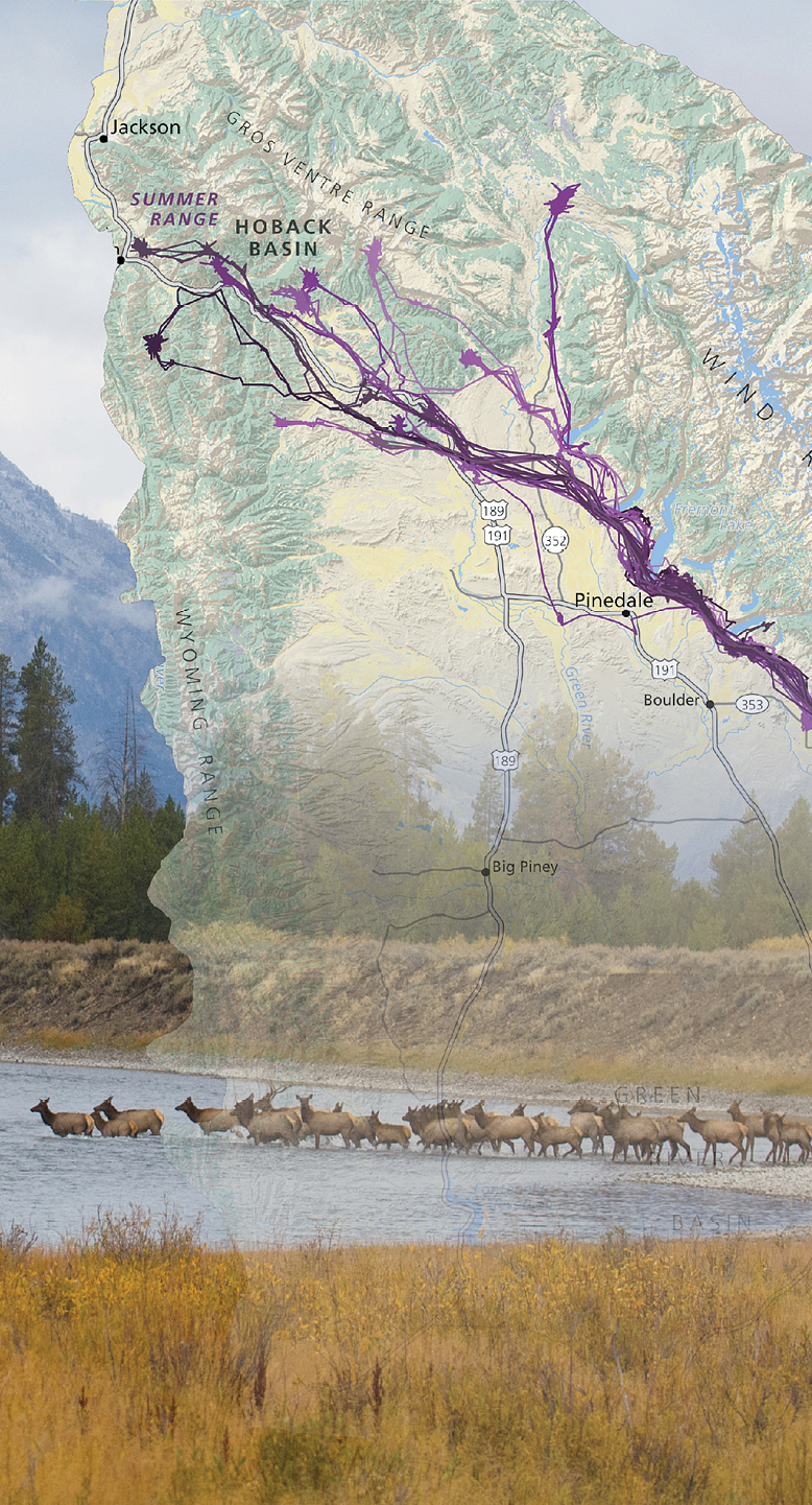
In 2013, one of Kauffman’s coauthors, Hall Sawyer, discovered the world’s longest mule deer migration route—about 150 miles.
The Wyoming Migration Initiative, an effort that Kauffman cofounded to bring attention to these migrations, published a glossy magazine-style “assessment” of the corridor in 2014, replete with UO InfoGraphics maps and charts.
Among the threats to the so-called Red Desert to Hoback migration corridor was a quarter-mile-wide bottleneck on private land where some 5,000 deer were funneled between Fremont Lake and the town of Pinedale. At the time, along the bottleneck, a parcel of land was up for sale that could have been developed into lakeside cottages, essentially severing the migration.
After the migration assessment was published and the bottleneck was identified as the top threat to the corridor, the nonprofit Conservation Fund raised $2.1 million to buy the land, remove the problematic fences, and protect it in perpetuity.
“That’s been the premier conservation success that our collaboration with the UO cartographers has brought, and that is now a wildlife habitat management area, managed to keep the bottleneck open,” Kauffman says.
“For a wildlife biologist, this is why you get into the field. You hope your science can lead to better management and conservation of these populations.”
—By Tim Christie, University Communications
Photos by Mark Gocke (top) and Scott Copeland Images; map by UO InfoGraphics Lab


