
A digital map can show you a whole lot more than points A, B, and the road between. You can attach huge amounts of data to a single digital location—population, climate, traffic patterns, soil quality, census results, pollution levels, biodiversity. And because of that, mapping has become big business.
You encounter geospatial technologies every time you use Google Maps or check in at a location on social media. But the industry also includes anyone who plugs databases of information into any kind of map, for any reason—say, to predict the behavior of people or animals.
At the University of Oregon, the geography department is seeing a growing wave of interest in the discipline. When Assistant Professor Christopher Bone introduced a course called Our Digital Earth four years ago, 25 people enrolled. This year, the class attracted 106 students. “The Department of Labor identifies it as a booming, booming employment sector,” says Associate Professor Amy Lobben. Almost half of all current geography majors have chosen geospatial technologies as their specialty, she notes.
Lobben studies how the human brain processes space and understands maps. Bone is a complex systems scientist who designs “agent-based models” that simulate the actions of individuals in computerized landscapes. Both use geographic information systems (GIS) to map and analyze data.
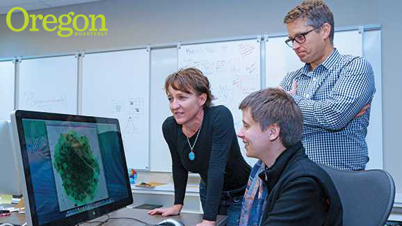
Now, they have a new space in which to collaborate: the Spatial Computation, Cognition, and Complexity Laboratory (nicknamed “SC3”), built over the summer in the basement of Condon Hall. They share the cozy Silicon Valley–style lab with a new faculty member, Assistant Professor Hedda Schmidtke, a computer scientist who specializes in geographic information sciences. “I think the combination is going to make a really great team,” Lobben says. “We’re being aggressive about building a more collaborative program.”
Lobben brings to the lab the work she had been doing at her Spatial and Map Cognition Research Laboratory. One of her recent projects, funded by the National Institutes of Health, involved creating a GIS map for the blind, in which sound performed the role usually filled by color and other visual elements. She’s also analyzing data on how two different areas of the brain help a map user relate the map to the physical world. “Navigating through space is a fundamental human activity,” she says. “It’s important for the species’ survival. And yet people have such different abilities to do it. You know people who you could drop anywhere and they could navigate out of the space. And you know other people, like me—I could stand in a classroom and have no idea which way is north.”
Lobben is particularly passionate about developing digital map technology for people with disabilities. She’s surveyed them to identify the kinds of information they need to successfully move around a city—sidewalk quality, curb-cut design, traffic speed and volume, installation of audible walk signs, and more—and integrated that data via GIS into an accessibility map of the city of Eugene. She’s delivered the map to the city, but she also hopes to develop an application that would function as a kind of Google Maps for the disabled. “We can create personalized route mapping for people,” she says.
Meanwhile, Bone brings to SC3 a four-year project to analyze the mountain pine beetle outbreak in western North America. “On a computer, you can simulate the beetles’ behavior—their attack behavior, their breeding behavior, their mortality—based on climate change and the state of the forest,” he says. “You can simulate their movement and how they disperse. And that gives us a better idea of how a native population of insects can turn into these large-scale epidemics.”
Models that work for beetles also work for humans. Bone and Lobben’s first collaboration at the new lab will simulate foot traffic in urban settings. Funded by the National Institute for Transportation and Communities, the project will, the researchers hope, lead to a tool for city planners and developers. “You can represent a city in a computer and have ‘people’ run around the ‘city’ with various cognitive abilities,” Bone says. “You can knock buildings down or put in a park and see if it creates any change in behavior.”
Schmidtke, the new addition to the team, brings a third dimension to SC3. As a pioneering assistant professor at Carnegie Mellon University in Rwanda, she developed information and communication technology for health care. Here, she has partnered with the geography department’s InfoGraphics Lab to develop an app for a local transit district that sends survey questions to riders as they board buses. “Her work is very different from what Amy and I do,” Bone says. “But I think collectively, our nexus is close enough that we can really complement and push each other in interesting ways.”
Recent geography grads are getting jobs at places like the New York Times, National Geographic, Apple, and firms in Silicon Valley, which is one reason the department is proposing a new major, spatial data science and technology. “Our hope is to make students more employable in this competitive market,” Bone says, “and also to attract students to the university to take this major. A lot of times they stumble upon geography and then discover spatial data science. We want them to come here to do spatial data science.”
—By John Strieder
John Strieder, a freelance writer and video producer, expects to earn his master’s degree in multimedia journalism from the UO in 2016.